 Poster: A snowHead
|
Arrived in Courchevl today, was 14 degrees down in the valley, sleety drizzly stuff here now, looks decidedly wet rather than snowy ... hoping it gets a bit colder later.
On the bright side there is still plenty snow around at least 
|
|

|
|
|
|
Obviously A snowHead isn't a real person
Obviously A snowHead isn't a real person
|
|
wow, cracking forecast for the next week or so, great timing I arrive back in the alps tomorrow, fat skis ready for action.
|
|
|
|
|
|
Well, the person's real but it's just a made up name, see?
Well, the person's real but it's just a made up name, see?
|
There is a lot of snow heading towards the Alps over the coming week.
Snowline (and strong winds) will make it tricky over the next few days, but at altitude there will be heavy snow.
Easter still looks cold.
|
|
|
|
|
|
You need to Login to know who's really who.
You need to Login to know who's really who.
|
|
Looks good to me. A dump tomorrow, then cold and often cloudy with occasional snow for the rest of the week. We arrive in La Plagne on Easter Saturday so should be well set up for a good week. Looks like my Easter gamble may be paying off.
|
|
|
|
|
|
Anyway, snowHeads is much more fun if you do.
Anyway, snowHeads is much more fun if you do.
|
|
It's already snowing hard in Chamonix. Raining in the town but snow on the hill.
|
|
|
|
|
|
You'll need to Register first of course.
You'll need to Register first of course.
|
alr1970, heavy sleet falling here at Plagne 1800.
But better than forecast rain
|
|
|
|
|
|
|
|
|
Just been out for a walk - raining steadily down towards the valley, alternating between sleet and rain at 1550 now I'm back in the dry looking out at it, with a beer. Looks absolutely miserable out on the pistes but once away from them, nice walking in the forest, out of the wind, seeing lots of little shoots of spring and some flowers already in bloom.
|
|
|
|
|
|
|
|
|
Raining here in Val Cenis at resort level. Ugh.
|
|
|
|
|
|
You'll get to see more forums and be part of the best ski club on the net.
You'll get to see more forums and be part of the best ski club on the net.
|
|
Still rain here in Courchevel @1850, nice fresh snow up top though. Meant to be getting colder this evening so hopefully the rain will turn to snow .... please snowgods!!
|
|
|
|
|
|
|
|
Raining here in Ste foy too. Apparently snowing at top of first lift so 1800m.
Fingers crossed turns to snow over night lower down.
Tuesday sounds like it will be windy off the scale
|
|
|
|
|
|
snowHeads are a friendly bunch.
snowHeads are a friendly bunch.
|
|
Peeing down in Nendaz, snow/rain line was about 1900m when I stooped skiing.
|
|
|
|
|
|
And love to help out and answer questions and of course, read each other's snow reports.
And love to help out and answer questions and of course, read each other's snow reports.
|
SLF's take.
"Weather forecast through Monday, 30.3.2015
Skies will be heavily overcast for the most part. Only in the furthermost southern regions can bright intervals be expected. In northern regions the snowfall is expected to be heavy. The snowfall level will fluctuate between 1200 and 1800 m.
Fresh snow
Between Sunday evening and Monday evening above approximately 2000 m, the following amounts of new fallen snow are anticipated:
Northern flank of the Alps, northern Valais, Lower Valais, northern Grisons, Silvretta, Samnaun: 40 to 60 cm
Remaining parts of Upper Valais, central Grisons, northern Lower Engadine: 20 to 40 cm
Northern Ticino, alto Moesano, Upper Engadine, remaining parts of Lower Engadine: 10 to 20 cm
Further south, less; or it will remain dry.
...
Wind
On the northern flank of the Alps, as well as in general at high altitudes, strong to storm-velocity westerly to northwesterly winds will be blowing.
Outlook through Wednesday, 1.4.2015
Tuesday
Skies are expected to be heavily overcast by and large. In the furthermost western regions, as well as on the northern flank of the Alps and in northern Grisons, snowfall is anticipated, which particularly during the night will be heavy, accompanied by storm-strength westerly to northwesterly winds. The snowfall level could temporarily ascend to above 2000 m, but otherwise will hover around approximately 1600 m. In southern regions, it will be quite sunny. In northern regions, the conditions for backcountry snow sports in outlying terrain away from secured ski runs will be critical. In addition, the temporarily heightened snowfall altitude level will make wet-snow avalanches more likely, particularly on north facing slopes.
Wednesday
In northern regions more than anywhere else, ongoing further precipitation can be expected. The snowfall level is expected to descend to below 1000 m. During the course of the day, scattered bright intervals will become evident. Strong velocity westerly winds will continue to prevail. In southern regions it will be sunny. The avalanche scenario will remain critical in northern regions. The danger of wet avalanches is expected to incrementally diminish as temperatures recede."
|
|
|
|
|
|
|
|
Just below Arc 1600 here and it was snowing down to about 1700m yesterday but it's come down below 1600 overnight and there's steady light snow right now. Getting a bit heavier in the last hour or so. If it stays cool then it's looking good 
|
|
|
|
|
|
You know it makes sense.
|
|
Chubby rain attempting to become snow here in Oz en Oisans (AdH) at 1350m, looks to have been raining all night so hopefully some decent snowfall higher up without the usually accompanying high winds today.
|
|
|
|
|
|
Otherwise you'll just go on seeing the one name:
Otherwise you'll just go on seeing the one name:
|
|
Plagne 1800. Went to sleep with drizzly sleet falling. Woken to white everywhere with thick snow falling steadily plus the wonderful sound of avalanche cannons firing off.
|
|
|
|
|
|
Poster: A snowHead
|
Blowing a hooley here in VT with a lot of new snow although it is difficult to tell how much is new stuff falling and how much is old being blown around. Lots of avvie work going on.
Challenge of the day....getting the kids fired up for their lesson @ 11! Vis improving since earlier but winds will be the problem.
|
|
|
|
|
|
Obviously A snowHead isn't a real person
Obviously A snowHead isn't a real person
|
|
Three kids to lessons at 9:15 here in La Ros - main challenge is how to get out of the drive. Been snowing since 12pm yesterday - a good 40cm on the car. Quite windy and no sign of the snow stopping!
|
|
|
|
|
|
Well, the person's real but it's just a made up name, see?
Well, the person's real but it's just a made up name, see?
|
|
Snow line exactly at Vallandry village level. Show at the top of the village, but clear at the bottom.
|
|
|
|
|
|
You need to Login to know who's really who.
You need to Login to know who's really who.
|
The only good thing about a heavy* snow fall this time of the year (which here in Serre we're not getting) is that it tops up the coverage on the mountain, then you wait for it to transform to spring snow.
Forecasts suggest for most of the French Alps it's going to be too windy for most of the week ?
*heavy as in weight - powder turning to sludge very quickly
|
|
|
|
|
|
Anyway, snowHeads is much more fun if you do.
Anyway, snowHeads is much more fun if you do.
|
|
Too warm here. Snow line was around ALpe Rauz driving over the Arlberg Pass this morning, but only accumulating around St Christoph (1800m).
|
|
|
|
|
|
You'll need to Register first of course.
You'll need to Register first of course.
|
|
@clarky999, it's going to drop down to about 1200m by Wed for the arlberg
|
|
|
|
|
|
|
|
|
It remains warm and sunny here in Vars in the southern french alps. Freezing level at about 2400 today. Pistes in good condition though, just a bit soft in the afternoon.
|
|
|
|
|
|
|
|
Upper to mid pistes very nice if a bit heavier than you'd ideally want here in Val Cenis. Rain - heavy - down at 1500 all jeffing day. Would be no odds if I didn't have 2 very young kids in lessons in the dowpnpour, their enthusiasm melting away like the snow on the home runs 
|
|
|
|
|
|
You'll get to see more forums and be part of the best ski club on the net.
You'll get to see more forums and be part of the best ski club on the net.
|
| Quote: |
their enthusiasm melting away like the snow on the home runs
|
I can imagine - it must be hard to persuade them that it's a sensible way to spend the day.
|
|
|
|
|
|
|
|
Can someone re-assure someone else (me) whom in theory could get our for a few days this week, albeit with the potential of family law proceedings waiting for him when he comes back, that between the avalanche risk, the lack of vis and, principally, the likelihood that the snow will be heavy and treacley almost immediately, that it really wouldn't be worth it?
Please. Just tell me not to go. But do it honestly. Treacle, focus on treacle.
|
|
|
|
|
|
snowHeads are a friendly bunch.
snowHeads are a friendly bunch.
|
|
That's easy. It's wet, windy and the vis is shite. Don't waste your money on law proceedings. There's always next season (really!).
|
|
|
|
|
|
And love to help out and answer questions and of course, read each other's snow reports.
And love to help out and answer questions and of course, read each other's snow reports.
|
|
|
|
|
|
|
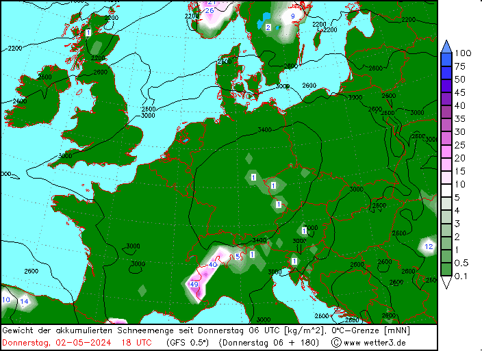
My German, or my meteorology isn't as good as I thought it was as I can't make sense of that!
|
|
|
|
|
|
You know it makes sense.
|
|
Cham-meteo reporting a more favorable few days forecast this morning. Rain this afternoon with initial FL 1800m but falling quickly to around 1000m at times. Cooler with snow showers over next few days with FL MUCH lower than the last few too but still breezy. I'll take that
|
|
|
|
|
|
Otherwise you'll just go on seeing the one name:
Otherwise you'll just go on seeing the one name:
|
yes the forecast has definitely cheered up a bit for the rest of the week as the main body of the storm has tracked further north.
The wind and avi blasting are still a factor this morning in many resorts but things should start getting back to normal from tomorrow
|
|
|
|
|
|
Poster: A snowHead
|
Engelberg closed due to storm-force winds this morning 
|
|
|
|
|
|
Obviously A snowHead isn't a real person
Obviously A snowHead isn't a real person
|
Isn't it wonderful when the forecasts are wrong!
snowforecast, meteobleu and meteoexploration all said today would be similar to yesteray: rain and wind. All wrong.
La-Plagne.com got it right for once.
Not much wind and lots of sunny periods this morning made for lovely skiing. Off piste still cement, but on-piste had 2cm of crystal coating (like lemon drizzle cake) which made first tracks interesting and fun.
Grey clouds came it around 1pm and threatened rain, so we came in for late leisurely lunch and a DVD
So now, which forecast do we trust for tomorrow?
Who cares. We'll just take what we get - at least all forecasts predict a significant drop in temperature.
|
|
|
|
|
|
Well, the person's real but it's just a made up name, see?
Well, the person's real but it's just a made up name, see?
|
|
Meteo France has had it pretty well right the last couple of days. Spot on with the FL. Maybe all the forecasts you've cited, @Jonpim, are GFS based?
|
|
|
|
|
|
You need to Login to know who's really who.
You need to Login to know who's really who.
|
|
pam w, could well be. I've tried to get meteofrance version of local weather, but only managed to get weather for La Roche (1250m). Rather different down there to what we got up here in 1800.
|
|
|
|
|
|
Anyway, snowHeads is much more fun if you do.
Anyway, snowHeads is much more fun if you do.
|
|
|
|
You'll need to Register first of course.
You'll need to Register first of course.
|
SLF this evening.
Observed weather on Tuesday, 31.3.2015
During the night the precipitation ceased. The morning was fairly sunny. As the day progressed, fresh cloud built up from the northwest.
Fresh snow
The following amounts of snow fell above 2200m in the period from Saturday afternoon until
Tuesday morning:
- Northern Alpine ridge, Valais excluding the Visp valleys: 60 to 90 cm, but up to 100 cm in some localities
- Rest of the northern flank of the Alps, Visp valleys, rest of the Gotthard region, rest of northern Grisons, northern Lower Engadine: 40 to 60 cm
- Central Grisons, Lower Engadine, northern - - -- Ticino excluding the Gotthard region: 20 to 40cm
- Further south: smaller quantities, even remaining dry in the south
- Temperature
At midday at 2000 m: between +2 °C in the east and +6°C in the inneralpine regions and the south
Wind
Northern flank of the Alps, Valais, northern Ticino, Grisons: strong to storm force from the west
Central and southern Ticino: mostly moderate from the northwest
Weather forecast through Wednesday, 1.4.2015
During the night, snow will begin to fall in the north. The snowfall level will drop below 1000 m. Snow will continue to fall until the evening. It will be fairly sunny in the south.
Fresh snow
The following amounts of snow will fall above approximately 1200 m in the period from Tuesday afternoon until Wednesday evening:
- Northern Alpine ridge from the Jungfrau region to the Tödi: 20 to 40 cm, but up to 50 cm in some localities
- Rest of the northern Alpine ridge, rest of Valais, remaining regions of northern and central - - ---
- Grisons north of the Inn: 10 to 30 cm
- Rest of the northern flank of the Alps, northern - Ticino and Engadine south of the Inn: 5 to 15 cm
- Further south: mostly dry
Temperature
At midday at 2000 m: about -8 °C in the north and -5 °C in the south
Wind
Strong to storm force from the northwest
Outlook through Friday, 3.4.2015
Thursday
Snow will fall continuously in the north. The main area of precipitation will consist of the northern Alpine ridge from the Aletsch region to the Alpstein region, and the northern regions of Grisons. 30 to 50 cm of snow could fall here. The wind will be strong to storm force from the northwest. The avalanche danger will continue to increase, in particular in the regions exposed to heavier precipitation. In the far west and on the southern flank of the Alps, only a little snow, or no snow at all, is likely to fall. Here, the avalanche situation will change very little.
Friday
Snow will continue to fall in the north, where further large quantities of fresh snow are possible. This applies in particular in the central and eastern parts of the northern flank of the Alps and in northern Grisons. The amounts of fresh snow remain uncertain. The avalanche danger will remain highly critical in the regions exposed to heavier precipitation.
|
|
|
|
|
|
|
|
Cold next week.
18z GFS is -12c below average for the middle of next week.

|
|
|
|
|
|
|
|
All that angst at the beginning of the season about how things were going to be completely dire and when will the snow come and yet the season has been pretty good with April shaping up to have an awesome end to it.
Certainly, from my memory, we have had a colder spring than usual and the snow is in great condition to last right to the end of the season with a big dump at just the right time.
|
|
|
|
|
|
You'll get to see more forums and be part of the best ski club on the net.
You'll get to see more forums and be part of the best ski club on the net.
|
| Quote: |
Certainly, from my memory, we have had a colder spring than usual
|
Not from my memory - we had a good few weeks with temperatures well above seasonal average. But it's cold now, and it's been snowing, and there is no doubt that the snow at Easter is going to be (as usual) better than it was at Christmas, in resorts right across the Alps. Far better, given how awful Christmas was.
|
|
|
|
|
|
|
|
|
@emwmarine, not from my memory either. Decidely and consistently warmer than seasonal averages throughout.
|
|
|
|
|
|
|
|


