Val Thorens had more snow overnight than yesterday. Some signs of break in the weather before more later. Probable total about 40cm during whole period. Windy and I suspect many lift closures due to that and the need to do some work before opening some pistes. Lots of avi explosions as the sun came up.
Obviously A snowHead isn't a real person
Obviously A snowHead isn't a real person
A strong Föhn is forecast Sunday and Monday, peaking around lunchtime on both days.
Windspeeds of up to 170kmh are being forecast in the mountains. Up to 130kmh in the valleys. This will shut lifts down and will blow you about unless you are tied down in the bar.
Well, the person's real but it's just a made up name, see?
Well, the person's real but it's just a made up name, see?
@nozawaonsen, what's your / their definition of a Föhn - I thought it was more of a High Pressure induced wind?
For me looking at the synoptic charts I see Europe dominated by a series of low pressure active fronts with tight isobars suggesting a strong W'ly backing SW/S'ly flow.
What causes the wind has nothing to do with its name. It is otherwise referred to as the Foehn affect.
As the wind rises on the windward side of a mountain it cools at a saturated adiabativ lapse rate of 1.8°/1000ft and then as it descends on the leward side it warms at a dry adiabatic lapse rate of 3°/1000ft causing a net increase in temperature. In the Rockies this wind is known as The Chinook which is a native Indian word for Snow Eater.
@Weathercam, it’s that SW’ly flow that will create the Föhn I‘m talking about.
In the Alps it’s the pressure difference north/south of the Alps which leads to the Föhn forming (and depending whether it is +/- will lead to a southern or northern Föhn).
“If we have a negative pressure gradient, that means the surface pressure in Zurich/Innsbruck is higher than in Lugano/Bolzano, north Foehn comes up over the Alps (wind from north). In the contrary case we have south foehn (wind from south).” [so for tomorrow the latter].
So in this case very deep low pressure to the north of the Alps along with that SW ‘ly flow and relatively high pressure to the south (in comparison to the north at least).
@horgand, not completely sure what you mean, but the strong winds and rising temperatures will certainly have a significant impact on the snowpack as will the heavy snow higher up and the rainfall lower down.
But temperatures tumble going into the start of the week along with further heavy snow and possibly more snowfall at the end of the week.
That snow is going to be falling on top of quite a complex snowpack which is going to have wind crust, snow drifts, rain crust and existing weak layers in it so off piste will need to be treated with caution with the avalanche risk level rising to 4 in places. Worth keeping an eye on davidof‘s thread.
You'll get to see more forums and be part of the best ski club on the net.
You'll get to see more forums and be part of the best ski club on the net.
Here‘s some ensembles!
A lot of snowfall likely this coming week, maybe calmer next week (though still cool) as higher pressure is edging in on both ECM and GFS, though that is definitely FI at this stage.
The Arlberg
Chamonix
Cairngorm
Sestriere
Eastern Pyrenees
Ski the Net with snowHeads
Ski the Net with snowHeads
Much more snow than expected in Oberösterreich today. Taps were on and off (mostly on) all day, but the skies have just cleared in the last 20 minutes.
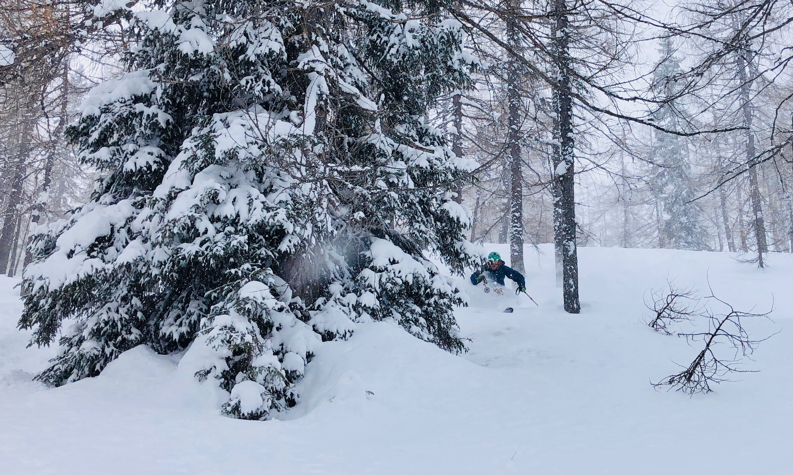
Lots of fun exploring my gf's home resort (her photo):
On Friday night, there was significantly more snowfall than had been anticipated, more than anywhere else on the northern flank of the Alps east of the Reuss, bringing 40 cm of fresh snow. On the northern flank of the Alps there was widespread snowfall, bringing 15 to 30 cm of fresh snow; in the other regions, less. Since the beginning of this period of precipitation on Thursday night, the following amounts of snowfall have been registered:
northern flank of the Alps, northern Valais, western part of Lower Valais, Prättigau: 20 to 40 cm over widespread areas; as much as 70 cm in parts of the Urner and Glarner Alps;
in the other regions of Switzerland, less; in the furthermost southern regions, it remained dry.
Temperature
At midday at 2000 m, between -13 °C in northern regions and -10 °C in southern regions.
Wind
Winds were northwesterly, blowing at moderate to strong velocity at high altitudes, at storm strength in some places; winds then slackened off somewhat during the course of the day.
On the southern flank of the Alps, intermittently strong-velocity northerly foehn winds were blowing.
Weather forecast through Sunday, 10.12.2017
Following a night of partially clear skies Saturday, precipitation coming from the west will rapidly set in as of the early morning hours on Sunday. The snowfall level in the early morning will still be at low lying areas, but subsequently will swiftly ascend, up to approximately 1800 m in the western part of Lower Valais and in the western sector of the northern flank of the Alps.
Fresh snow
By Sunday evening, the following amounts of fresh snow are anticipated:
western sector of the northern flank of the Alps, Valais not including the valleys of Visp, Simplon region and southern Goms: 20 to 40 cm; more in some places of the furthermost part of Lower Valais;
valleys of Visp, Simplon region and southern Goms, as well as the central and eastern sectors of the northern flank of the Alps: 15 to 30 cm;
Ticino and Grisons: 5 to 15 cm.
Temperature
At midday at 2000 m, between 0 °C in northern regions and -12 °C in southern regions.
Wind
Winds on the northern flank of the Alps, and in other regions at high altitudes in particular, will be blowing at strong to storm strength from westerly to southwesterly directions. In the northern alpine valleys, strong to storm-strength foehn wind will be blowing.
Outlook through Tuesday, 12.12.2017
Monday
On Monday, the greatest amounts of precipitation are anticipated in the furthermost western regions, as well as on the Main Alpine Ridge, particularly from the Lukmanier Pass into Val Müstair and southwards therefrom. Only a small amount of precipitation is anticipated between the Bernese Oberland and Liechtenstein, in northern Grisons and in the Engadine. In those regions, a foehn storm will be raging. The snowfall is expected to ascend to nearly 2000 m in western and in northern regions.In southern regions it will lie between 500 and 1000 m. The avalanche danger is expected to increase markedly from the Lukmanier Pass into Val Müstair and southwards therefrom more than anywhere else; in the other regions of Switzerland, avalanche danger levels are not expected to change significantly.
Tuesday
On Monday night, intensive snowfall is anticipated on the Main Alpine Ridge from Lukmanier Pass into Val Müstair and southwards there from more than anywhere else.The precipitation is expected to extend towards or into central Grisons. In the remaining regions of Switzerland, markedly less precipitation is anticipated. The snowfall level will descend. Thereafter, the southwesterly air current is expected to weaken incremenatally. But the avalanche danger will remain critical over widespread areas.”
And love to help out and answer questions and of course, read each other's snow reports.
And love to help out and answer questions and of course, read each other's snow reports.
clarky999, wonderful!
So if you're just off somewhere snowy come back and post a snow report of your own and we'll all love you very much
So if you're just off somewhere snowy come back and post a snow report of your own and we'll all love you very much
Met O forecasting a minimum of minus 13 for Braemar tomorrow morning. A maximum of 7 in London. A 20 degree range across the Uk
You know it makes sense.
You know it makes sense.
Well....my son is waiting for me in zurich and we have a car rented for 2 weeks....about to board and cross the pond....i understand the forecast is challenging but you will forgive me being completely....STOKED.
Otherwise you'll just go on seeing the one name:
Otherwise you'll just go on seeing the one name:
nozawaonsen wrote:
Nostalgia isn't what it used to be, I imagine that in those days there were no talks about helmets, fitness or weight. The gals just got their skirts and thick tights on and went skiing.
Poster: A snowHead
Poster: A snowHead
DB wrote:
nozawaonsen wrote:
Nostalgia isn't what it used to be, I imagine that in those days there were no talks about helmets, fitness or weight. The gals just got their skirts and thick tights on and went skiing.
That's why everyone died at 50 of rickets back in the day.
Obviously A snowHead isn't a real person
Obviously A snowHead isn't a real person
Whitegold wrote:
DB wrote:
nozawaonsen wrote:
Nostalgia isn't what it used to be, I imagine that in those days there were no talks about helmets, fitness or weight. The gals just got their skirts and thick tights on and went skiing.
That's why everyone died at 50 of rickets back in the day.
....and syphillis of course
Well, the person's real but it's just a made up name, see?
Well, the person's real but it's just a made up name, see?
Quote: "Met O forecasting a minimum of minus 13 for Braemar...." Who gives a sh*t about Braemar?
At 1400 in Serre last night we had -11.5 and my thermometer is always a few degrees warmer I think on the side of the house.
This morning the good news is that it is -7 and snowing - the good part is the -7 as some models have 0 and warming up and raining in the valley later - if we can hang on to -1 at least then we'll continue with the snow.
If you want to see it snowing in the garden then click on link in signature.
Will go up the hill around lunch time to take a look, no rush me thinks
Then you can post your own questions or snow reports...
Then you can post your own questions or snow reports...
@Weathercam, I'll be keeping an eye on that bird table
After all it is free
After all it is free
Absolutely nuts this morning in Verbier! 50cm in the garden and it’s supposed to snow all day today and tomorrow with up to another metre forecast. Never seen anything like it. And I can’t ski 🤬
You'll get to see more forums and be part of the best ski club on the net.
You'll get to see more forums and be part of the best ski club on the net.
janny wrote:
Quote: "Met O forecasting a minimum of minus 13 for Braemar...." Who gives a sh*t about Braemar?
Well anyone who is considering skiing at Glenshee might be interested in the weather and snow conditions there......
Ski the Net with snowHeads
Ski the Net with snowHeads
ECM (yr.no) says freezing level should about 1300 meters and 22mm of rain in Chamonix right now, but webcams clearly show inches of lovely snow. I thought freezing level and snow line was about the same? Is the forecast just wrong or am i missing in some basic weather knowledge? Could one hope for snow down to village level in Cham tomorrow as well?
snowHeads are a friendly bunch.
snowHeads are a friendly bunch.
staffsan wrote:
ECM (yr.no) says freezing level should about 1300 meters and 22mm of rain in Chamonix right now, but webcams clearly show inches of lovely snow. I thought freezing level and snow line was about the same? Is the forecast just wrong or am i missing in some basic weather knowledge? Could one hope for snow down to village level in Cham tomorrow as well?
It varies, but snow line is usually 3-400 meters below freezing level.
And love to help out and answer questions and of course, read each other's snow reports.
And love to help out and answer questions and of course, read each other's snow reports.
@staffsan, same happening here in Serre Che. Forecast for today was temps circa 4 degrees and rain. What we have is minus 5 and loads of snow - just hope the temps stay this cold for tomorrow as well and we'll get substantial accumulations in the valley.
I tend to find that the Z850 plot is the most accurate and last night we indeed saw minus 11.5
Though I see that Deux Alpes at 1650 is getting rain now
So if you're just off somewhere snowy come back and post a snow report of your own and we'll all love you very much
So if you're just off somewhere snowy come back and post a snow report of your own and we'll all love you very much
@Weathercam, where do you get that chart?
You know it makes sense.
You know it makes sense.
@staffsan, was still snowing when I talked to my s.i.l. At around 1600 but raining in Samoens.
Forecast to rain overnight. We probably had around 50cms in the garden since Friday night.
Given how much has fallen in last few days, and what it fell on to, a wee bit rain won’t do any harm.
Otherwise you'll just go on seeing the one name:
Otherwise you'll just go on seeing the one name:
@under a new name, Nice. Keep some untracked spots for me, ill just be six weeks from now!
According to Morris the next 6 days will bring 270cms of snow to cham at top level. Thats more than some resorts get a whole season, no? I still havent gotten my head around the current storm, do people believe its a great snowbringer or is the föhn and rain gonna spoil a lot? Are good things happening or not?
@staffsan, at lower levels the storm will bring rain, at higher levels it will bring snow. The wind will blow it all around a lot.
Up high this will lead to an increased avalanche risk and tomorrow there are likely to be some lift closures.
When it’s calmed down and if you can find safe places to ski there should be some excellent off piste over the next few days. Medium term it’s certainly good for piste skiing which should be superb once the wind dies down.
And it increases the depth and the complexity of the snow pack off piste, a bit of a double edged sword (on the plus side it will bury lots of rocks and roots).
The rain will actually stabilise the snow pack in some places lower down (further down still it will wash away thin amounts of snow).
Plenty of resorts get lots more than 270cm of snowfall in a season.
What it means for six week’s time? Who knows. But it’s arguably better than an extended mild drought...
Well, the person's real but it's just a made up name, see?
Well, the person's real but it's just a made up name, see?
@nozawaonsen, but what's of interest is that thankfully we're not getting what was forecast - and for a change it's too our advantage.
Though a spanner can still be thrown in the works and I would not be surprised to see all this lovely snow by this time tomorrow consolidate into a third of what we have now.
Then you can post your own questions or snow reports...
Then you can post your own questions or snow reports...
well, its a warm current at least
After all it is free
After all it is free
try the anglicised "foehn".
Seriously, we ought (!!!) now be reasonably set up for the season. Prolonged warm wet weather would screw that up (at least at lower altitudes) but that's not showing up on the forecasts I watch. Seems pretty cold as far out as can reasonably be forecast (and beyond).
So, cautiously optimistic.
The fact that some of the Chamonix areas with limited water capacity for snow making have been running the cannons this early, plus that much of the piste network is already pisted (thus, compacted and more robust to melting) all means good things for xmas and new year.
You'll get to see more forums and be part of the best ski club on the net.
You'll get to see more forums and be part of the best ski club on the net.
It's German for hairdryer, doh
Ski the Net with snowHeads
Ski the Net with snowHeads
Motorway shut at Sion due to too much snow - not common!


 Poster: A snowHead