 Poster: A snowHead
|
| nozawaonsen wrote: |
The next few days look cold...
looks like producing cold temperatures and snow on the southern side of the Alps (particularly for example the Alpes Maritimes like Isola 2000 and parts of Italy like Limone Piemonte both of which have been suffering so far this season) and Pyrenees.
How prolonged and deep the cold spell will be is uncertain, but GFS seems to hint at a shift around 07 February. |
yeeeha!
|
|

|
|
|
|
Obviously A snowHead isn't a real person
Obviously A snowHead isn't a real person
|
|
nozawaonsen, What's the 3V outlook like? Looking very cold until Saturday but then what's forecast? Cheers
|
|
|
|
|
|
Well, the person's real but it's just a made up name, see?
Well, the person's real but it's just a made up name, see?
|
|
|
|
You need to Login to know who's really who.
You need to Login to know who's really who.
|
|
Told my customers to prepare for a misty and snowy day and the sun came out..........they are all now sunburned and I've got tired legs from the bonus day skiing off piste!!!
|
|
|
|
|
|
Anyway, snowHeads is much more fun if you do.
Anyway, snowHeads is much more fun if you do.
|
Hells Bells, firstly just to clarify what I'm sure you know already, but it doesn't really get too cold to snow, just that very cold air is often associated with stable high pressure.
In this case though we could see low pressure from the Mediterranean pushing in around the middle of next week which could well provide snow for the French Alps and parts of Italy, but the further south the better. Which could mean more snow for Serre Chevalier middle of next week and also the Three Valleys, though probably more the further south you are.
That said whilst very cold is looking very likely over the Alps, potential snow is much harder to call. Here's how WRF sees next Tuesday.
Tuesday 31 January 1500
Here's GFS showing the coldest part of the weather being modeled at present for next Friday/Saturday overnight.

From around 07 February GFS is keen to push snowy weather across the northern Alps again, but you want to watch to see how that develops before having any confidence in it.
|
|
|
|
|
|
You'll need to Register first of course.
You'll need to Register first of course.
|
|
Where are you getting GFS maps for 7 Feb from Noz? The one I look at on meteociel only goes out to 6/2.
|
|
|
|
|
|
|
|
By Thursday and particularly Friday it looks like there will be a strong wind to add to some very cold temperatures.
Foehn chart.
Bise chart.
Snow looks like pushing into the French Alps and across the Italian border tomorrow.
WRF 31 January 0600
It's focus looks like being the Southern French Alps.
WRF 31 January 1200
Wednesday looks like being clearer, possibly cloud lower down, but will also see the temperatures begin their plunge. GFS then keeps things very cold and pretty dry with possibilities of light snow on Thursday and Saturday.
In terms of keeping warm lots of advice elsewhere, but I'd suggest:
- Layering (no more than four ideally) to keep your core warm.
- Make sure that you have got minimum exposed flesh, don't stand around faffing outside, so have agreed what you are doing and where you are going from one place to another.
- Don't touch metal with bare flesh (so ski poles or lift bars) as it will cool your hands quickly.
- Make sure you take off layers when you go into a warm hut or cafe as otherwise you will sweat which will quickly turn cold when you go outside again.
- Do stop at cafes and huts to get warm, have a snack and keep hydrated. If you need to text someone look at the map, faff etc, do it in the cafe. Make sure you have got all your warm clothes on (including gloves and hates ect) before you leave the cafe/hut.
- Have fun, plan, don't faff.
Touring round the Arlberg last week I was really struck by the number of full depth slides and plentiful glide cracks. As mentioned before this is a problem across much of the northern side of the Alps this year because of the way the heavy snow arrived this year on relatively mild ground.
Here's a good piece on the subject from Lawinenwarndienst Tirol.
Meist günstige Bedingungen: Das Hauptproblem bilden Gleitschneelawinen und frische, gut erkennbare Triebschneepakete
- [Despite a generally settled snowpack] Full depth slides [Gleitschneelawinen] remain a massive problem.
- Full depth slides are associated with glide cracks, the timing of when they will release is unpredictable. Avoid the areas beneath these cracks.
- The glide cracks can often be covered with fresh snow or wind driven snow.
- Full depth slides can release at any time of day or night and at any temperature.
Here are some ensembles.
Les Deux Alpes.
Chamonix.
The Arlberg.
Hintertux.
Sestriere.
Folgaria.
Zermatt.
Cairngorm.
Eastern Pyrenees.
Bad Gastein.
You can see from the charts below (produced from GFS data) the colder temperature anomalies across Europe.
10 day temperature [based on 12z GFS]
10 day precipitation [based on 12z GFS]
|
|
|
|
|
|
|
|
|
Based on this morning's output an extended very cold and dry period is looking increasingly certain. The best chance of any substantial snow is tomorrow, particularly the southern French Alps. After that there look to be chances of intermittent snow showers cropping up from time to time, but nothing significant. The very cold temperatures look like extending through the first week of February, before rising to cold and below average for the second week (charts over the last 48 hours have suggested potential for snowier outbreaks, but the current patent to beat is very cold and dry).
|
|
|
|
|
|
You'll get to see more forums and be part of the best ski club on the net.
You'll get to see more forums and be part of the best ski club on the net.
|
|
Second week of Feb is our trip, Nozza, so I'm now more than an "interested observer"! Wigglies for PdS look like it's warming up to something below average about 12/2, and a few wiggles suggesting a bit of precipitation.
|
|
|
|
|
|
|
|
So i'm into the final countdown to my holiday, 5 more sleeps!!! Looking at the latest weather charts, it will be very cold, somewhere in the region of -20 when arrive in the 3V and with a few cm of fresh snowfall and then sunny clear skiers, YIPEE!!! 
|
|
|
|
|
|
snowHeads are a friendly bunch.
snowHeads are a friendly bunch.
|
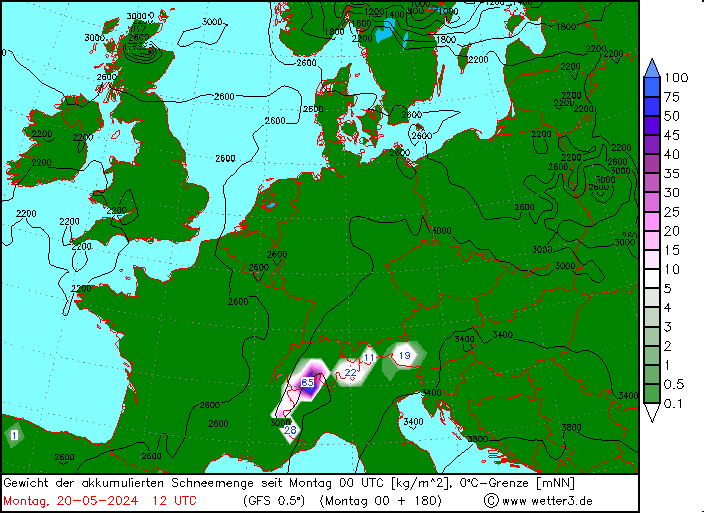
This seems to be suggesting large snowfalls in the south. Any skiing in Italy at the "161"? Where is that?
|
|
|
|
|
|
And love to help out and answer questions and of course, read each other's snow reports.
And love to help out and answer questions and of course, read each other's snow reports.
|
|
|
|
|
|
After today's snowfall in the west it hard to really see beyond very cold and dry for at least the next week.
Should feel nice and fresh.
|
|
|
|
|
|
You know it makes sense.
|
| nozawaonsen wrote: |
After today's snowfall in the west it hard to really see beyond very cold and dry for at least the next week.
Should feel nice and fresh. |
Any sniff of freshies after this cold spell? What is the currently probability of this cold extending?
|
|
|
|
|
|
Otherwise you'll just go on seeing the one name:
Otherwise you'll just go on seeing the one name:
|
| nozawaonsen wrote: |
After today's snowfall in the west it hard to really see beyond very cold and dry for at least the next week.
Should feel nice and fresh. |
Sounds like a perfct week in the 3V next week then. Cold, dry and sunny???
|
|
|
|
|
|
Poster: A snowHead
|
|
|
|
Obviously A snowHead isn't a real person
Obviously A snowHead isn't a real person
|
this morning's snow was a lot heavier than forecast earlier - meteo france upped their forecast for this morning to 3 snowflakes, after I went to bed last night. It started heavily around 6 am, it seems, and created general chaos. I had to drive into Les Saisies early for a cross country ski lesson. The road had not been ploughed and was pretty snowy, and the wretched navettes were just getting their chains on as I drove past the garage at abut 0845 - far too late. One woman, who has small kids to get into lessons, failed to turn up this morning and another was late, having had to catch the navette from Hauteluce, after it was extricated from a minor crash with a truck. She said there were cars "a travers" all over the road. I was fortunate - our road was quiet and having managed to get past the plough and its huge piles of snow I had a cleared road for the rest of the journey. After a 2.5 hour lesson there was masses of snow on the car - a good 6 - 7", maybe more, and it took me a while to get back again. They were caught napping, I think. Once again, as has been the case consistently all year, snow-forecast massively underestimated the amount - because GFS did, I guess.
Anyway, was beautiful dry fresh snow, makes braking on cross country skis soooooooooo much easier, and it was stunningly beautiful in the trees, away from the clatter of the lifts. But I am now knackered. 
|
|
|
|
|
|
Well, the person's real but it's just a made up name, see?
Well, the person's real but it's just a made up name, see?
|
|
Heavy snow in the Geneva area today, seemingly heavier in Geneva than where I am about 15 miles around the lake where it has snowed a lot (and is still going) but the roads are fine.
|
|
|
|
|
|
You need to Login to know who's really who.
You need to Login to know who's really who.
|
|
latest snowforecast for Zermat shows the low temperatures easing a bit into the middle of next week. Hope so as it was looking a bit chilly. The froth will still be freezing on my beer though!
|
|
|
|
|
|
Anyway, snowHeads is much more fun if you do.
Anyway, snowHeads is much more fun if you do.
|
|
Has ECM taken his ball away? Or do we have good consistency between that and GFS?
|
|
|
|
|
|
You'll need to Register first of course.
You'll need to Register first of course.
|
RetroBod, 
|
|
|
|
|
|
|
|
|
Just wondered what ECM says for later next wk vs GFS?
|
|
|
|
|
|
|
|
Beyond the deep cold... there is a fair amount of uncertainty.
It looks like this weekend will see temperatures hit their lowest points and early next week is likely to see them rise slightly (to below average rather than far below average).
Little model consistency, but some suggestions in this evening's output in both GFS and ECM that snowier weather might be on the cards around the middle of next week. Slightly earlier on GFS, 06 Feb compared to ECMs 08 Feb. Slightly colder on ECM. GFS FI then goes on to return cold from the east in mid month, but too far out to have any confidence.
|
|
|
|
|
|
You'll get to see more forums and be part of the best ski club on the net.
You'll get to see more forums and be part of the best ski club on the net.
|
|
|
|
|
|
|
|
|
snowHeads are a friendly bunch.
snowHeads are a friendly bunch.
|
| Quote: |
To help deal with the extreme cold, the Army has been put on standby.
|
 Pure Daily Fail! Last time it snowed on Salisbury Plain they could't leave their Barracks as they had no snow clearing equipment. Pure Daily Fail! Last time it snowed on Salisbury Plain they could't leave their Barracks as they had no snow clearing equipment.
|
|
|
|
|
|
And love to help out and answer questions and of course, read each other's snow reports.
And love to help out and answer questions and of course, read each other's snow reports.
|
|
|
|
|
|
The article goes on to say that we're going to suffer temperatures lower than the South Pole... which is currently in... erm... summer...
|
|
|
|
|
|
You know it makes sense.
|
|
Also "The rolling white hills of Somerset disappear in the distance following a heavy covering of snow"... Looks like a few cm to me...
|
|
|
|
|
|
Otherwise you'll just go on seeing the one name:
Otherwise you'll just go on seeing the one name:
|
Yup, it's a balmy -27.8C on top of the South Pole at the moment. I'd be a little surprised if it was that cold.
Back in the Alps it certainly will be cold and I wouldn't be surprised to see that sort of temperature or lower cropping up in the eastern Alps this weekend (at similar altitudes). In the meantime occasional intermittent light snow fall could make an appearance, but nothing substantial looking over the next five days. The next few days look like broken cloud lower down (clearer in the west), clearer at altitude.
Next week looks like heralding less cold temperatures, and raises the possibility of fresh snowfall, but little more than a possibility at present.
|
|
|
|
|
|
Poster: A snowHead
|
Hi staying in aviemore for the first time over half term any ideas what its going to be like next week - worried as it looks like mon may be warming up 
|
|
|
|
|
|
Obviously A snowHead isn't a real person
Obviously A snowHead isn't a real person
|
Garethb, yup looks that way. After that it's less clear. And by half term who knows.
In the Alps tomorrow should see further light snow in parts of the Italian Alps.
WRF 1200 02 February
Clearer Friday.
WRF 1200 03 February
Light snow potentially back in the eastern Alps on Saturday.
WRF 1200 04 February
Cold building towards the weekend and with a wind from the north east to add a bit of bite amongst the hochnebel.
From next week it does look like heading back to more normal temperatures. Possibly shifting back to a northwesterly flow next week which could bring more snowfall next week, but a lot of uncertainty.
Incidentally you can see from the Arctic Oscillation how the pattern shifted in the second half of January. Which has brought around much colder temperatures and more snowfall in the southern Alps than there was earlier in the season. Where it goes next is unclear at present.
|
|
|
|
|
|
Well, the person's real but it's just a made up name, see?
Well, the person's real but it's just a made up name, see?
|

18z GFS operational was interesting in that whilst it did raise temperatures a bit at the start of next week it kept them below average all the way into mid February and then took then colder. If it verified much of next week would be cold, with snow arriving in the Alps around 10 February and building after that.
That said anything beyond this weekend is very tricky at present.
(and in terms of the UK even more finely balanced, GFS increasing likelihood of snow over much of England on Saturday, though this waxes and wains with each run).
Here's the Met Office three month temperature outlook for the UK incidentally.
Met Office 3-month Outlook
"So far this winter frost, snow and ice have been limited and largely confined to the north of the UK; whilst the forecast for February is very uncertain the risk of adverse wintry weather is very much higher than hitherto, and the south looks most vulnerable.
The forecast for February-March-April is also very uncertain, but hints at an outcome that is colder than we have become accustomed to in the last decade."
"As snow and ice frequency in winter is more closely related to temperature than to rainfall, the signal that slightly favours drier-than-average conditions should not be misinterpreted as meaning less snow. In fact based on the temperature forecast and other considerations there is an elevated risk, at least in February, of some snowfalls over the UK."
|
|
|
|
|
|
You need to Login to know who's really who.
You need to Login to know who's really who.
|
|
They've changed their tune - its only a little while ago that they said no appreciable cold weather spell
|
|
|
|
|
|
Anyway, snowHeads is much more fun if you do.
Anyway, snowHeads is much more fun if you do.
|
|
Yes, they have updated it. The last one was issued in December, this one in February. Can't see anything wrong with that really?
|
|
|
|
|
|
You'll need to Register first of course.
You'll need to Register first of course.
|
Noza-san, the AO link you posted shows a predicted steep decline in a couple of weeks. If this occurs, would this lead to an intensifying of the current cold outbreak, with associated dry spells? I know AO isn't the only measure, but I'd like to become more familiar with it's habits.
Muchos gracias for your stellar updates too! We all owe you a debt.
|
|
|
|
|
|
|
|
Cold-temperature records being neared or broken in many parts of the world this week.
South Korea down to around -20c.
Bulgaria down to -30c.
Finland reaching almost -40c.
Alaska hit nearly -60c.
|
|
|
|
|
|
|
|
Some impressions from Lawinenwarndienst Tirol.
Einige impressionen
- Still fantastic powder snow.
- Though sun and wind is now effecting the snow at both high and low altitude.
- Gleitschneelawinen or full depth slides remain the greatest threat.
- When they will release is unpredictable, and they can release even on very cold days, avoid the areas below glide cracks.
Dread Pirate Roberts, firstly remember that the AO is simply a way of describing the relative position of low pressure and high pressure systems. But yes a negative AO tends to be more likely to produce cold (not necessarily the extreme cold we currently have) and dry weather in the northern Alps (and that is broadly how GFS sees it this morning). It tends to send low pressure on a more southerly track. As to where it goes next if you look at the ensemble mean it has quite a spread from the middle of next week. This uncertainty can also be seen in the Met Office three month forecast above.
Light snow playing back and forth in Alps over the next few days amongst the cold. Here's how it appears on WRF.
Light snow in western Italy today and pushing into Switzerland.
WRF 1200 02 February
Light snow overnight Friday/Saturday in Austria.
WRF 0000 04 February
Again Saturday evening.
WRF 2100 04 February in Austria
|
|
|
|
|
|
You'll get to see more forums and be part of the best ski club on the net.
You'll get to see more forums and be part of the best ski club on the net.
|
|
|
|
|
|
|
Netweather having an aberration....+4deg tomorrow.......don't think so!!
|
|
|
|
|
|
|
|


