Autumn equinox is just about 24 hours away (0904 tomorrow).
And some rather pleasant warm and sunny weather looks like it's heading towards the Alps for next week (and indeed much of Europe by the look of things with a possible Indian Summer perhaps making up a little for some of the poor weather during actual summer... ).
The Met Office has decided to put a little distance between itself and some of the recent excitable media reporting.
"To provide some context it certainly would not be a surprise to see overnight frosts and even some snow across higher parts of Scotland in October. Historically, looking at the long term climatology, snow falls on around 3 or 4 days in a typical October across the Highlands of Scotland and on 1 or 2 days in the Southern Uplands and northern Pennines."
In the meantime more snow heading towards New Zealand this weekend.
Here's Dan Corbett on NZ Met Service's Powder Watch.
nozawaonsen, thanks for posting that (would have missed it otherwise) - they are of course quite right that snow and some frosts aren't that unusual in the Highlands at this time of year and in fact you can get flurries even during the summer months (there was unusually decent snowfall at the end of August that lay in gullies for a few days). If it lay for any length of time (days/weeks) that would be unusual of course but frankly I don't expect that. It's always nice to see the first snows of the winter popping up on the cams wherever you may be looking, Alps, NA, Scotland, but certainly in Scotland, and I guess elsewhere, what we're looking for is a cooling of the ground so that when the bigger dumps hopefully come in November/December the snow is lying on cold ground rather than warm and starts to build up a base.
It's good to see winter moving in though and lets hope it's a good one wherever we are
Then you can post your own questions or snow reports...
Then you can post your own questions or snow reports...
nozawaonsen,
apart from yourself, what sites/people are worth listening to in regards to weather/snow forecast,s, i know alot of people are not fans of snow-forecast, i myself like looking at meteo france, i know from reading your comments that these website,s base their predictions on models that you look at too when forming opinions, but who is the most consistently accurate !!
After all it is free
After all it is free
So on the eve of the equinox...
Time to see whether there are any sort of trends or too much confusion... (remembering not to take this very seriously).
- CFS sees a cold end to autumn and cold for much of winter, average or warmer than average for the end of winter and spring.
- JAMSTEC is back to a colder winter.
- NASA now sees a cold anomaly from mid winter to early spring.
- IRI has pulled back from the cold anomalies of the last couple of months and now sees an average winter.
Winter blocking? (cutting off the Atlantic, bringing cold in from the north and east).
- No sign of northern blocking.
- Beijing Climate Centre suggests possible blocking over Scandinavia, but no sign over Greenland.
[worth saying that the northern blocking pattern for early last winter started really becoming apparent towards the end of September].
Drier than average winter?
- CFS has been pulling back a bit from a drier winter. But still has a stronger signal for drier weather to the east and even more so to the south.
- JAMSTEC has precipitation on the drier than average.
- IRI sees average.
- NASA sees average.
Winter in the UK?
- CFS has a colder than average end to autumn and start to winter, end of winter and summer warmer than average.
- JAMSTEC has colder than average through winter and spring.
- IRI sees average.
- NASA sees average.
It is still far too off in the distance for any confidence, but the continuing trend seems to suggest a higher chance of colder start to winter over the Alps and the UK, quite possibly drier than average (though average conditions have also been favoured at times). As we move through autumn it will be interesting to see if this pattern is sustained and strengthens or whether it shifts.
You'll get to see more forums and be part of the best ski club on the net.
You'll get to see more forums and be part of the best ski club on the net.
The slighest of upwards shifts gives us an ENSO figure of
-0.61 up from -0.62 last week. So remaining (just) in very weak La Nina territory for now.
(Broadly in line with the JAMSTEC seasonal outlook for Japan)
Last edited by Ski the Net with snowHeads on Sun 25-09-11 14:57; edited 2 times in total
snowHeads are a friendly bunch.
snowHeads are a friendly bunch.
Looking West...
Klaus Wolter has some thoughts on the impact of La Nina on Colorado.
"My forecast for the next six months is not optimistic, especially for southeastern Colorado. Thanks to La Niña, the mountains have a good chance of getting close to normal snowfall in mid-winter (to be fine-tuned in the next two months). A repeat of last year's record-breaking snows is unlikely.
Bottomline (Double-Dip La Niña): In our state, 2nd year La Niña winter half-years are often drier than in the previous year. There is little evidence that would support a contrary (wet) viewpoint. This statement does not factor in 'rogue atmospheric river events' (like the one in December 2010) that are currently not predictable at the seasonal time-scale."
Wolter mentions the ECMWF ENSO forecast "... the 'gold standard' for all ENSO forecast models.."
- And also for Canada. - which looks like it would be good for Whistler if it came to pass.
And love to help out and answer questions and of course, read each other's snow reports.
And love to help out and answer questions and of course, read each other's snow reports.
Interesting take on last season (from a US perspective) in the Adventure Journal, reflecting that Northern Hemisphere snow cover was hardly universally good last season (fairly obvious if you were in the Northern Alps) and even in the US it was far from one way traffic.
5-25% well above average
25%-40% well below average
So a higher probability for a well below average winter in the Alps. But of course doesn't mean that's how it will play out...
So if you're just off somewhere snowy come back and post a snow report of your own and we'll all love you very much
So if you're just off somewhere snowy come back and post a snow report of your own and we'll all love you very much
Met Office also doesn't see much likelihood of blocking over Greenland this winter, suggesting a pattern more akin to that being seen by CFS and Beijing Climate Centre.
There is some suggestion (stronger in the August output) of increased potential for blocking over Scandinavia in early winter. Which, were it to occur, opens up some interesting potential (cold from east meeting low pressure systems from the Atlantic). So worth keeping a watch for.
Also worth noting that as well as seeing increased probability for a cold January-December-February in the Alps (see above), the Met Office September output also suggests an increased probability for below or well below average temperatures across the Alps in early winter too, November-December-January.
The August output had a similar pattern with an increased probability of below and well below temperatures for early winter over the Alps.
You know it makes sense.
You know it makes sense.
nozawaonsen wrote:
Met Office also doesn't see much likelihood of blocking over Greenland this winter, suggesting a pattern more akin to that being seen by CFS and Beijing Climate Centre.
There is some suggestion (stronger in the August output) of increased potential for blocking over Scandinavia in early winter. Which, were it to occur, opens up some interesting potential (cold from east meeting low pressure systems from the Atlantic). So worth keeping a watch for..
Could that mean a similar weather pattern as a couple of seasons ago when Scotland got lots and lots of nice light dry powdery snow coming down from the north east, rather than warmer wet systems coming in off the west?
"Negative NAO... are associated with La Nina in November and December, but with El Nino in January and February."
At this stage there is not much of a signature to suggest the strong Greenland blocking (associated with a strongly -ve NAO) which we saw last year and the year before. Potentially this would chime with a less starkly contrasted winter/spring than last year... (and a lower likelihood of a sharply cold UK winter).
But definitely worth keeping an eye on and there are currently short term suggestions of a more negative NAO pattern following the current warm spell, which could see colder weather trying to push down (certainly through Scotland) towards the end of the first week in October.
Poster: A snowHead
Poster: A snowHead
Latest ENSO figure edges up just a tiny bit further from -0.61 to... -0.6
"...un hiver assez froid et plutôt long... l'hiver pourrait être moins brutal que l'année dernière, mais les périodes de temps froid devraient être plus durables, en tous cas plus étalée sur la durée de l'hiver 2011 / 2012...Un point inquiétant tout de même : la persistance d'une relative sécheresse qui ne permettra pas aux nappes phréatiques de se reconstituer après une année 2011 sèche."
- Quite cold and long winter.
- Winter less brutal than last year, but with the cold spread across the length of winter 2011/12.
- A note of concern however [could be] the persistent dryness.
Interesting piece by Wasatch Weather Weenies on the double edged sword of early snow.
nozawaonsen, is it too soon to enquire what it might be like on the glacier in Tignes the week beginning 15 October?
Well, the person's real but it's just a made up name, see?
Well, the person's real but it's just a made up name, see?
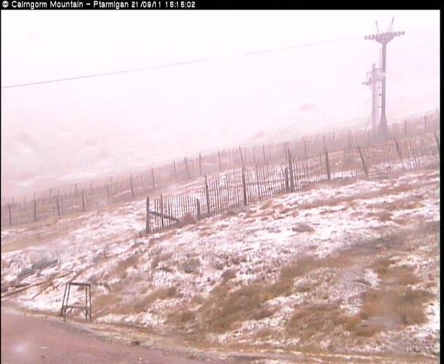
Stunning morning with the sun rising through the Autumn mist.
Pedantica, the short answer of course is that it's too soon to tell. What is noteworthy is that it is looking increasingly likely there could be quite an abrupt end to the current fine weather from the middle of next week.
This morning's GFS suggests temperatures will be 15 to 20c lower by the end of next week from where they are this weekend. That's quite a drop, and whether it is quite that sharp remains to be seen (some of the other output over the last few days has been less dramatic), but there have been recurring suggestions (not certain at this stage) that we could shift to a more northerly pattern at some time next week.
If it did evolve like that it could certainly make things cold enough for snow down to the valleys in the Alps (and it could be rather cold in Scotland too).
At present snow looks possible at the end of next week in the eastern Alps.
One of the key contributing factors in the exceptional cold weather in the UK (and elsewhere in Europe) last November and December was the blocking high which established itself over Greenland. This allowed cold Arctic air to pour down from the North.
This chart (CFS) shows the current six monthly outlook for pressure anomalies.
What is very evident is that even by mid September in 2010 northern blocking (shown by the red shading) was clearly evident for early winter and late autumn and no such pressure anomalies are apparent for winter this September.
Obviously that's not the only route to cold winters in the UK. Also as a long range model, it is susceptible to the same reliability issues of all long term models.
But the same blocking that was being forecast over Greenland last year is noticebly absent in the forecasts for winter this year (so far).
Meanwhile a cooling down of temperatures in the Alps by the end of next week looks likely, but whether it is a return to seasonal averages or something colder is rather uncertain.
Further west here's a piece from Colorado Powder Forecast on how things might evolve in Colorado over the next week.
"The pattern which may be developing during the first half of October is one which some long range forecasters believe increases the chances of the development of high pressure cells over Scandinavia during the winter months. These can bring brutal cold to the UK from the east, more often during the second half of the winter than the first."
Last night's 18z GFS provided an example of a Scandinavian high (though one which the model has dropped this morning)
And you can see how in this scenario the colder air would reach down into Europe (though not in this example reaching the UK) from the north east.
Whether this develops or not will of course depend, but worth keeping an eye out for...
Then you can post your own questions or snow reports...
Then you can post your own questions or snow reports...
Im so fascinated by all this...please keep it coming !
After all it is free
After all it is free
nozawaonsen wrote:
And you can see how in this scenario the colder air would reach down into Europe (though not in this example reaching the UK) from the north east.
Whether this develops or not will of course depend, but worth keeping an eye out for...
Yep, interesting obervations from Brian Gaze. Closer to home, with the temperature gradient shifting south by 7 to 8 degrees (of latitude not celcius) per month at this time of the year, the scenario above would set a good early season snow base for Cairngorm, Glenshee & Lecht if it came to fruition just 4 weeks later.
You'll get to see more forums and be part of the best ski club on the net.
You'll get to see more forums and be part of the best ski club on the net.
I know this is a bit random. But could someone please predict or give me a forecast for the Lake District and more specifically Helvellyn for the date of Friday 14th October. Im doing a bit of hiking and would like it to be cold!!!
Ski the Net with snowHeads
Ski the Net with snowHeads
Ricklovesthepowder, i don't think anyone can predict that far out.
snowHeads are a friendly bunch.
snowHeads are a friendly bunch.
Ricklovesthepowder, as rogg says you certainly can't really "predict" the weather that far out, at least not with any confidence. However, the Met Office do a 30 day forecast for the UK which offers some ideas. What I would say is that at that range it is inevitable that forecast accuracy will be limited.
However, at present it looks more likely than not that we will see a more autumnal feel to our weather as the month progresses (there are some indications from recent GFS runs that more warm weather could be on the way, but I'm yet to be convinced).
Here's an extract from the Met Office 30 dayer.
"UK Outlook for Friday 7 Oct 2011 to Sunday 16 Oct 2011:
... [The] next week is expected to stay unsettled across many areas at first with further spells of rain or showers, and perhaps some snow over the Scottish mountains. However southern and eastern parts tending to become more drier and settled as the week goes on..."
Anyway being October I'm off to laze on the beach for a while...
[Edit: some interesting charts starting to come up for the Alps...]
And love to help out and answer questions and of course, read each other's snow reports.
And love to help out and answer questions and of course, read each other's snow reports.
nozawaonsen wrote:
... at present it looks more likely than not that we will see a more autumnal feel to our weather as the month progresses (there are some indications from recent GFS runs that more warm weather could be on the way, but I'm yet to be convinced).
Anyway being October I'm off to laze on the beach for a while...
It's p1ssing down with rain today, so it was yesterday and up to Tuesday last week, most of last month and most of the summer. The current 'heatwave' delivered us 2 nice days; Wednesday and Friday daytime, as a kind of sandwich to the rain on Thursday before the rain set in again on Friday evening. I think it's fair and reasonable and I'm sure the weather gods will concur that in order to put nature in balance, the upcoming ski season in Scotland should be absolutely epic.
So if you're just off somewhere snowy come back and post a snow report of your own and we'll all love you very much
So if you're just off somewhere snowy come back and post a snow report of your own and we'll all love you very much
It's been looking for the last few days like the end of next week could bring some colder weather after the exceptional warmth (much of) Europe has been enjoying recently.
The last three GFS runs have underlined this potential and produced runs for the Alps which not only take it cold at the end of the week, but even when they warm up slightly the week after have kept things below average. Of course the outlook beyond next weekend is still subject to considerable change, but things do seem to be firming up around a cold a rather snowy snap in the Alps at the end of the coming week...
At present snowfall is looking like it would be more likely in the eastern Alps.
Last edited by So if you're just off somewhere snowy come back and post a snow report of your own and we'll all love you very much on Wed 5-10-11 21:58; edited 1 time in total
You know it makes sense.
You know it makes sense.
This is how CFS saw winter and spring 2011/12 during the second half of September.
Changes from previous forecast in square brackets.
- probability of a colder start to winter across the whole of Europe [though in recent runs this was reducing especially in UK]
- drier than average conditions likely in the Alps throughout winter, and throughout spring for Southern French Alps/North East Italy.
- colder weather reaching up until the end of January [a switch to average temperatures in February]
- Spring looking warmer than average across Europe.
Consistency continues to build around a colder than average start to winter from CFS, a pattern that the model has been developing since spring [but it was weakening especially in the UK in the last few runs]
Pre season (October, November, December).
No longer being show in the seasonal probability range. In terms of anomalies this has shifted from slightly cooler to average over the course of the run.
Early Winter (November, December, January).
Scotland - Colder than average, drier than average.
Western Alps - Colder than average, average precipitation.
Eastern Alps - Colder than average, drier than average.
Southern French Alps/North East Italy - Colder than average, drier than average.
Winter (December, January, February).
Scotland - Colder than average, wetter than average.
Western Alps - Colder than average, average precipitation.
Eastern Alps - Colder than average, drier than average.
Southern French Alps/North East Italy - Colder than average, drier than average.
Late Winter (January, February, March)
Scotland - Average temperatures, wetter than average precipitation.
Western Alps - Average temperatures, average precipitation.
Eastern Alps - Average temperatures, average precipitation.
Southern French Alps/North East Italy - Average temperature, drier than average.
Early Spring (February, March, April)
Scotland - Warmer than average temperatures, wetter than average.
Western Alps - Warmer than average temperatures, average precipitation.
Eastern Alps - Warmer than average temperatures, drier than average.
Southern French Alps/North East Italy - Warmer than average temperatures, drier than average.
Spring (March, April, May)
Scotland - Warmer than average temperatures, average precipitation.
Western Alps - Average temperatures, average precipitation.
Eastern Alps - Warmer than average, wetter than average.
Southern French Alps/North East Italy - Warmer than average, drier than average.
It's been quite noticeable how the CFS model has been gently pulling back from colder conditions in Europe (and particularly the UK) in the last week of this period. It will be interesting to see how it handles the next fortnight.
One point worth noting is that CFS still sees a rather strong La Nina developing. Stronger than last year between 0.2 and -0.25, that would be rather surprising. ECM, JAMSTEC and UKMO all see a more moderate La Nina events (between about -0.75 and -1.5). I don't know how much influence the ENSO forecast has on CFS' seasonal forecasts for Europe, but one assumes it must have some and that discrepancy over the ENSO forecast could yet be notable (and possibly may suggest their forecast is slightly milder than it might be otherwise).
Interesting to note that the first CFS model (CFS has two versions) sees the event peaking between -1.0 and -1.5 which seems closer to a number of other models. Albeit the version linked to the seasonal probability forecasts is more aggressive and sees a stronger event (see above).
ZAMG have put out a OND forecast with November cooler than average and December milder. The latter is a bit of a surprise given that most models go cold or average. Obviously like all LRF's you need to treat it with caution. And ZAMG were noticeable in that they increasingly pushed July (which was very cold) as being warmer than avenge in their forecasts.
Never the less worth adding to the mix.
Poster: A snowHead
Poster: A snowHead
Continues to look cold and potentially snowy from Friday in the Alps. Snowfall looks like it would be heavier in the eastern Alps (Bergfex is suggesting a metre of snow falling at Hintertux).
Early next week temperatures pick up again, before looking like they might drop once more later in the week (colder further east).
It's just over a fortnight since the last wintery outbreak in the Alps. As with the last snowfall it won't last in the valley's long, but it could set things up nicely on sone of the glaciers.
Obviously A snowHead isn't a real person
Obviously A snowHead isn't a real person
nozawaonsen,
i have been watching as you know the weather with interest the last few years. It does seem to me that the eastern side of the alps normally gets off to the best start, is that true and if so why
Well, the person's real but it's just a made up name, see?
Well, the person's real but it's just a made up name, see?
East (more continental and less influenced by the Atlantic) is certainly colder, on average 2C colder, in winter. That translates to roughly 300m in terms of altitude.
He's shifted his forecast towards a milder outlook for winter, with the winter months average and high pressure dominated and the spring milder than usual. We'll see.
Shorter term there is a possibilty appearing in this evening's runs of a second band of snow which might arrive in the Eastern Alps around 11 to 12 October. It'll be interesting to see if it is still there tomorrow.
GFS's 18Z control run provides Scotland with a proper winter storm and the first sight of winter Atlantic blocking with height rises towards Greenland. And it's only 10 days away ...
Anyway, snowHeads is much more fun if you do.
Anyway, snowHeads is much more fun if you do.
nozawaonsen wrote:
Continues to look cold and potentially snowy from Friday in the Alps. Snowfall looks like it would be heavier in the eastern Alps (Bergfex is suggesting a metre of snow falling at Hintertux).
Early next week temperatures pick up again, before looking like they might drop once more later in the week (colder further east).
It's just over a fortnight since the last wintery outbreak in the Alps. As with the last snowfall it won't last in the valley's long, but it could set things up nicely on sone of the glaciers.
Yes looks like it could be the start, at least at altitude. Maybe some of this snow will still be there in spring
Meteo France going cold for October November December.
Interestingly the only one to go warm was CEP or ECMWF/CEP which is what ZAMG draws on (see above) for it's seasonal forecast.
After the first band of cold weather (bringing snow, particularly to the eastern Alps, from Friday) there is a bit of a split in the models over how next week plays out.
ECM keeps high pressure over the continent keeping cold weather to the North.
GFS has the high pressure over the Atlantic allowing the cold to push down south swiping parts of the UK and into the Alps.
Then you can post your own questions or snow reports...
Then you can post your own questions or snow reports...
I came across this which is hinting at colder global temps:
You'll get to see more forums and be part of the best ski club on the net.
You'll get to see more forums and be part of the best ski club on the net.
There really could be quite bit of snow this weekend in the eastern Alps. This is the meteogram for St Anton (it's derived from the GFS operational run and I suspect is slightly over doing things, but never the less...).
Looking slightly less likely this evening that there will be a second band of snow following through in the middle of next week.
Having crept up ever so slightly for the last three weeks the ENSO figure drops a little to -0.63. Still weak La Nina.
Ski the Net with snowHeads
Ski the Net with snowHeads
nozawaonsen, they have been giving out the O bis O warnings for us here in Oberbayern the past couple of days. That means October to Ostern (Easter) and is the recommended period for having winter tyres on.
The forecast is for snow down to 800m maybe even lower as of tonight. The weather systems bringing that little lot are going to be responsible for a temperature drop of over 20°C in less than 12 hours starting at midday and the weather is due to clack in for about 4 days. So the glaciers will get a timely topping up, especially the Kitzsteinhorn and Sölden (which only has 2 weeks before the World Cup opening races.


 Poster: A snowHead