 Poster: A snowHead
|
@nozawaonsen, 
|
|

|
|
|
|
Obviously A snowHead isn't a real person
Obviously A snowHead isn't a real person
|
|
|
|
Well, the person's real but it's just a made up name, see?
Well, the person's real but it's just a made up name, see?
|
@Weathercam, five letter word starts with P?
Very jealous have fun! 
|
|
|
|
|
|
You need to Login to know who's really who.
You need to Login to know who's really who.
|
Jealous but also very stoked for those of you booked in Western Italy, Southern France and parts of Switzerland -- Zermatt with pow should be great.
WePowder said there is potential for the Northern Alps to get hit just after Christmas, but it's speculative at best at the moment. Anyone have any insight on that? I'm not much of a Weather Jedi.
|
|
|
|
|
|
Anyway, snowHeads is much more fun if you do.
Anyway, snowHeads is much more fun if you do.
|
| AthersT wrote: |
@Weathercam, five letter word starts with P?
Very jealous have fun! |
Pizza?
|
|
|
|
|
|
You'll need to Register first of course.
You'll need to Register first of course.
|
Better 12z GFS. Starts to offer options for snow in northern Alps from Christmas.
Currently trying to snow in Vienna.
|
|
|
|
|
|
|
|
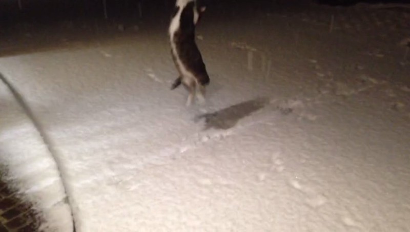
My girlfriend's cat is enjoying hunting snowflakes at around 600m in Oberösterreich tonight:
Here in Tirol it's merely cold and cloudy.
|
|
|
|
|
|
|
|
|
Still nothing in this evening's 12z output that really suggests a fundamental shift, but clearly Italy and the margins will do well in the next few days.
|
|
|
|
|
|
You'll get to see more forums and be part of the best ski club on the net.
You'll get to see more forums and be part of the best ski club on the net.
|
So tonight's 'event' is almost upon us. Cross fingers for Austria. I'd take a cosmetic layer across western Austria at this point. Looking great in the next couple of days for the lucky people in northwestern Italy.
Further out, the ECM 12z is holding firm on snow during 23rd-26th Dec, and has slightly upgraded snow chances for the northern Alps again:
- A sprinkling for most of Austria and Switzerland on the 23rd.
- Generally less for France, but at least delivers a white Christmas and a couple of inches to the northern French Alps on the 25th, as well as most of the north side.
- A further spell for Austria into Boxing Day.
Good to see after days of the GFS showing increasingly dry outcomes during Christmas.
DISCLAIMER: These are not predictions, but merely descriptions of what this particular run shows.
On a related note, here's a paragraph from an Accuweather preview of the weather in Europe/the North Atlantic over the Christmas period:
"Both of these potential storms will not just develop out in the Atlantic, but will be coming from the northern Pacific Ocean and traveling across North America over the upcoming days. It is once these systems are on land that we will get a slightly better picture of what is going to happen. Depending on each track across North America for these storms will determine how much influence the Azores high pressure has on their track in the North Atlantic Ocean, either deflecting their track towards western Iceland or towards the open waters north of Scotland. What will also play a big role is the ridge of high pressure that will be settled across much of eastern Europe. At the moment, this ridge looks to be pretty strong with at least a 1036 mb high pressure in place, which will deflect any storms trying to move eastward into northern Europe towards Iceland and the North Pole."
Point being, the storms we're looking at for the Christmas period are currently baby storms in the middle of the Pacific Ocean, which gives rise to a few thoughts:
- How cool that is.
- How funny it is to be worrying about predicted snowfall totals when the system supposedly bringing that snow has at this point barely been born, on the other side of the world.
- How insanely brilliant these weather models are for being able to get as close as they generally do get from a week out.
If you fancy checking out these storms following their predicted tracks from inception, you can do just that using the GFS Northern Hemisphere charts.
|
|
|
|
|
|
|
|
@WellingtonBoot, just look at the forecast differentials for Serre Che, Abries Ristolas, St Veran, Pragialetto, Montgenevre, Prali and you'll see major differences in forecast accumulation over the next 48hrs that can still change!
They are all give or take within a couple of hours drive from where we are, we often see differences of 20-30cm from one valley to another within 10km radius.
So whilst storms might be brewing in the Pacific Ocean, it's total bollox as to what will eventually happen in the hills here!
So whilst you might be looking at your runs we here on the ground, far closer to where the action is / might be, are still not too sure where to head off to until it starts dropping out the sky 
|
|
|
|
|
|
snowHeads are a friendly bunch.
snowHeads are a friendly bunch.
|
|
Gran Montets Friday, Verbier Saturday and Courmayeur today. We had a lot of fun on some really nice pistes.
|
|
|
|
|
|
And love to help out and answer questions and of course, read each other's snow reports.
And love to help out and answer questions and of course, read each other's snow reports.
|
|
@Weathercam, Hm, I think you may have completely missed the point I was trying to make? Unless you simply mean to reiterate?
|
|
|
|
|
|
|
|
|
@Weathercam, +1
|
|
|
|
|
|
You know it makes sense.
|
@Weathercam, -1
there, we're all square now....you are both right, it is pretty cool to learn where a storm might start, and even better where it might end up
|
|
|
|
|
|
Otherwise you'll just go on seeing the one name:
Otherwise you'll just go on seeing the one name:
|
|
18z is another run which starts to see the high pressure block come under pressure itself, with systems from the Atlantic starting to break through from Christmas. It's not a dramatic collapse, but if it were to happen it would mark a shift that would allow at least some snow into the northern Alps.
|
|
|
|
|
|
Poster: A snowHead
|
|
Weather Underground is now forecasting snow in the northern Alps for Saturday -- Monday (12/24-12/26) with more on Wednesday. Nothing dramatic -- few inches here and there -- but I'll take it. Any chance this could swell should the systems coming across the Atlantic develop into something larger?
|
|
|
|
|
|
Obviously A snowHead isn't a real person
Obviously A snowHead isn't a real person
|
|
Just seen a picture of it snowing in Soll tonight. Happy days. Hopefully start of things to come.
|
|
|
|
|
|
Well, the person's real but it's just a made up name, see?
Well, the person's real but it's just a made up name, see?
|
|
@ArlbergMeister, it's possible of course, but too far out too tell at this stage and nothing to suggest that at this point. A step in the right direction perhaps though.
|
|
|
|
|
|
You need to Login to know who's really who.
You need to Login to know who's really who.
|
| Quote: |
@ArlbergMeister, it's possible of course, but too far out too tell at this stage and nothing to suggest that at this point. A step in the right direction perhaps though.
|
@nozawaonsen Yes, a move in the right direction for sure!
|
|
|
|
|
|
Anyway, snowHeads is much more fun if you do.
Anyway, snowHeads is much more fun if you do.
|
|
Radar suggests all the snow is getting caught on the Nordstau, and western Switzerland is getting some surprise snowfall - will be interesting to see how that develops. Still desperately hoping for some sign that it's going to clamber over and snow on the inner alpine Tirol. Lech and the Arlberg might do OK here, along with more northern Austrian areas.
|
|
|
|
|
|
You'll need to Register first of course.
You'll need to Register first of course.
|
|
@langball, Awesome.
|
|
|
|
|
|
|
|
|
|
|
|
|
Currently snowing lightly in Tignes 
|
|
|
|
|
|
You'll get to see more forums and be part of the best ski club on the net.
You'll get to see more forums and be part of the best ski club on the net.
|
|
And in Les Masses - it may not be much but it does lift the spirits!!!
|
|
|
|
|
|
|
|
|
Woken up to about 5cm in Schladming village! Hopefully a fair bit more up on the mountain?..
|
|
|
|
|
|
snowHeads are a friendly bunch.
snowHeads are a friendly bunch.
|
Snowing in Bourg d'Oisans. Welcome sight 
|
|
|
|
|
|
And love to help out and answer questions and of course, read each other's snow reports.
And love to help out and answer questions and of course, read each other's snow reports.
|
And snow on the roads and roofs in La Plagne 1800 
|
|
|
|
|
|
|
|
|
A dusting in VT this morning as well - it's very welcome
|
|
|
|
|
|
You know it makes sense.
|
|
Dusting of snow in Les Arcs, and it continues with the snow equivalent of drizzle. Wasn't there some chat last week about snow around the 19th?
|
|
|
|
|
|
Otherwise you'll just go on seeing the one name:
Otherwise you'll just go on seeing the one name:
|
|
|
|
Poster: A snowHead
|
|
|
|
Obviously A snowHead isn't a real person
Obviously A snowHead isn't a real person
|
|
Light dusting in Meriblel village this morning.
|
|
|
|
|
|
Well, the person's real but it's just a made up name, see?
Well, the person's real but it's just a made up name, see?
|
| rob@rar wrote: |
| Dusting of snow in Les Arcs, and it continues with the snow equivalent of drizzle. |
Looks like Les Arcs is on the far western edge of the snow, which I assume is falling in the 'retour d'est' pattern. Looking across the Tarentaise to the western side of the valley it doesn't look like any snow has fallen there, but on the eastern side of the valley, where Les Arcs is, the ground is definitely white from the dusting of snow. Often with retour d'est snow Les Arcs doesn't get anything, so perhaps a little bit of weather has crept over the main alpine ridge to give us a dusting here. Wonder if the top end of Val d'Isere is getting more at the moment?
|
|
|
|
|
|
You need to Login to know who's really who.
You need to Login to know who's really who.
|
Still trickling down here in 1800.
I watch a handful of weather sites avidly.
Some had snow for tonight and tomorrow, and all had it going cold - none had snow for today, and many had sun with clouds.
Seems they all had to do a sudden about turn: now they're all listing snow since 0500, with the temperature going up!
So much for all those models and computers - i'll be following Chadspurs40 from now on.
|
|
|
|
|
|
Anyway, snowHeads is much more fun if you do.
Anyway, snowHeads is much more fun if you do.
|
|
|
|
You'll need to Register first of course.
You'll need to Register first of course.
|
|
|
|
|
|
We have probably known this low was coming for the last week...
Everyone was pretty conservative with the falls though.
|
|
|
|
|
|
|
|
| Jellybeans1000 wrote: |
We have probably known this low was coming for the last week...
Everyone was pretty conservative with the falls though. |
But like I said the actual accumulations will differ widely - and that is really what you can't forecast.
The Genoa Low / Retour D'Est or whatever you want to call this low - is known for it's "micro climate" characteristics.
I've now been in the vicinity of this low twice and have seen how conditions can differ drastically from one valley to another, as the low can stall over one mountain and let loose all it's precipitation, whilst elsewhere just gets a dribble!
|
|
|
|
|
|
You'll get to see more forums and be part of the best ski club on the net.
You'll get to see more forums and be part of the best ski club on the net.
|
lol - yes that was me
meteox going for what looks like a decent amount of snow starting early hours 19th
|
|
|
|
|
|
|
|
| Weathercam wrote: |
I've now been in the vicinity of this low twice and have seen how conditions can differ drastically from one valley to another, as the low can stall over one mountain and let loose all it's precipitation, whilst elsewhere just gets a dribble! |
It is the same issue with the Atlantic weather systems. Exterior ranges such as the Beaufortain can be blitzed and there can be half as much snow in Tignes (interior ranges) and barriers like the Col du Lauteret can completely block the Southern Alps from these N-W storms. (basically rain shadow, the weather system sheds moisture when pushing over the mountain ranges leaving less precipitation for the next valley). Fortunately for the Alps there is the Mediterranean which means that both sides of the range should pick up snowfall during an average season.
Last edited by Ski the Net with snowHeads  on Mon 19-12-16 11:16; edited 1 time in total on Mon 19-12-16 11:16; edited 1 time in total
|
|
|
|
|
|
|
|


