 Poster: A snowHead
|
Still looking like a return to winter Friday onwards, just been looking at Gressoney (FL circa 1800) and a lot more forecast than down here in Serre though looks like we'll get more than a dusting.
Have friends flying into Turin on Sat and they have not ordered a 4x4 or chains as they did not think in mid April that they'd need them!
Weather here still grim, do feel sorry for those who were out last week and now this week. Don't think we've seen the sun much since last Wed!
|
|

|
|
|
|
Obviously A snowHead isn't a real person
Obviously A snowHead isn't a real person
|
Some heavy snow coming at the end of the week for the Swiss Italian border (Monterosa) and western end of Austria.
Snowline looks quite a bit lower in Austria.
|
|
|
|
|
|
Well, the person's real but it's just a made up name, see?
Well, the person's real but it's just a made up name, see?
|
|
@Weathercam, I think booking a non-snow ready car in mid April is a reasonable risk provided they keep an eye on the forecast and are prepared to buy, and use, chains if necessary.
|
|
|
|
|
|
You need to Login to know who's really who.
You need to Login to know who's really who.
|
Gressoney is in Monterosa................
@pam w, and yes, that's what he said / thought.
Only trouble is that unless you ski the storm, that's when it's actually snowing, the fresh snow at this time of year will quickly get heavy, that said looks like cold spell could well last into the Monday with a clear sky, so could be a road trip up there on Sunday night and crash on their floor !
|
|
|
|
|
|
Anyway, snowHeads is much more fun if you do.
Anyway, snowHeads is much more fun if you do.
|
|
Snow melts on the roads pretty quickly in April compared to Feb!!!
|
|
|
|
|
|
You'll need to Register first of course.
You'll need to Register first of course.
|
@kitenski, but it's the temps - that said the tarmac does keep it's heat, but if that amount of snow does fall and it is that cold then I think could be tricky getting up the last 10 or so km to Gressoney.
Mind you La Grave's looking good for Monday and it's a damn site shorter drive, decisions, decisions...........
|
|
|
|
|
|
|
|
|
New April snow on a warm road can be very slippy. Had to put chains on my snow tyres once, though the road (which I'd driven up lots of times in snow, without chains) was dry a few hour later.
|
|
|
|
|
|
|
|
|
@Weathercam, just curious but how many days skiing do you get in each year???
|
|
|
|
|
|
You'll get to see more forums and be part of the best ski club on the net.
You'll get to see more forums and be part of the best ski club on the net.
|
|
@Weathercam, true, are they driving up at night?? Don't forget to remind them to add winter additive to the diesel to stop it freezing if temps are dropping!!
|
|
|
|
|
|
|
|
@horgand, for me it's not about the number of skiing days, but about the quality. I have not been out for nigh on a week now as conditions are so bleak. I also don't really ski the piste unless I'm skiing with friends, or doing slack country.
KenX is also the same, he'll be working on his house waiting for the right conditions, even then we'll only ski the morning.
Normally at this time of year with a freeze melt cycle happening with overnight clear skies and sunshine in the morning we'd be doing slack country (going off the back or resort and then skinning back up to a lift) skiing spring snow, or ski touring further afield.
Even though the lifts close here 24th April we could still be skiing into May depending on the snow, though that's not been the case since 2009!
And being in the mountains is not just about skiing, today done a three hour loop on the bike taking me to PSV and back. Having the bike also opens up other options in that I can drop the van off in the sunny afternoon in another valley and cycle back home then ski to the van off the back the next morning!
@kitenski, don't think it's going to be uber cold to worry about that, minus 10 maybe tops.
@pam w, it's the wet snow that gets me coming up my hill.
|
|
|
|
|
|
snowHeads are a friendly bunch.
snowHeads are a friendly bunch.
|
|
@Weathercam, yep. Gressoney is indeed in Monterosa. Not quite sure what your point was.
|
|
|
|
|
|
And love to help out and answer questions and of course, read each other's snow reports.
And love to help out and answer questions and of course, read each other's snow reports.
|
After the likely snowfall in parts of the Alps at altitude at the end of this week temperatures look like rising again.
Here's ECM's view on anomalies middle of next week.

Post mid month (a way out) GFS is suggesting a short period of cooler temperatures with fresh snow, but clearly that's some time away and details will shift.
|
|
|
|
|
|
|
|
|
|
|
You know it makes sense.
|
|
|
|
Otherwise you'll just go on seeing the one name:
Otherwise you'll just go on seeing the one name:
|
@Weathercam, yes my Haute Tarentaise / Aosta ski touring next week not looking good with the frigging Foehn wind and light refreeze .
A season of ups and downs , after such a poor start then an amazing recovery the end of season which showed so much potential looks like turning into a bit of a damp squid .
|
|
|
|
|
|
Poster: A snowHead
|
@Rob Mackley, yes I have two lots of friends who were heading Aosta way for touring etc, though at the beginning of this week looked like they'd be getting some powder in for a day or two. It's going to be tough either way finding good conditions, just have to stay well above 3,000m
I've just been speaking to friends in La Grave, as was thinking about going over there tomorrow and lift is closed, supposedly due to bad snow, but they must have had a fair amount the last couple of days, but I know that no one is around. My friends hotel is closed till the weekend as they have no clients, sort of vicious circle, with the lift closed no one will come up 
|
|
|
|
|
|
Obviously A snowHead isn't a real person
Obviously A snowHead isn't a real person
|
|
A damp squib indeed - it's like the Lake District this morning in Courchevel. Warm, damp, still - not been out yet.
|
|
|
|
|
|
Well, the person's real but it's just a made up name, see?
Well, the person's real but it's just a made up name, see?
|
SLF's view.
"Observed weather on Tuesday, 5.4.2016
During the night the north was mostly cloudy. During the day there were isolated bright spells in the regions exposed to the foehn wind. The south was mostly very cloudy and snow fell above approximately 2000 m, easing as the day progressed.
Fresh snow
The following amounts of snow fell in the period from Sunday evening until Tuesday evening:
- Between the Monte Rosa and Nufenen Pass along the border between Upper Valais and Italy, and in northwestern Ticino: 30 to 50 cm
- Val Bregaglia and the Bernina region: 15 to 30 cm
- Rest of the main Alpine ridge from the Great St Bernhard Pass to the Bernina Pass and to the south: 10 to 20 cm
- Further north: smaller quantities or no snow at all
Temperature
At midday at 2000 m: between +7 °C in the north and +2 °C in the south
Wind
Strong in the mountains, storm force at times during the night, from the south
Weather forecast through
Wednesday, 6.4.2016
During Tuesday night some snow will fall, initially in the west and later in the east as well. The snowfall level will drop to approximately 1600 m. In the east there will be further snow showers in the morning. It will then become mostly cloudy, but dry. There will be bright spells from the west and in the south as the day progresses.
Fresh snow
By Wednesday evening the following amounts of snow will fall above approximately 2400m:
- Northern flank of the Alps and the Gotthard region: 10 to 20 cm
- Other regions: 5 to 10 cm over a wide area
- Central Ticino, Sotto Ceneri, Engadine: a few centimetres or none
Temperature
At midday at 2000 m: between +1 °C in the north and +4 °C in the south
Wind
Moderate southwesterly at elevated altitudes, easing during the day
Outlook through Friday, 8.4.2016
Thursday
In the morning there will be further bright spells in the west and in Valais. Otherwise it will be mostly very cloudy and some snow will fall. The danger of dry avalanches will decrease in the regions where it is considerable; elsewhere it will not change significantly. Individual full-depth avalanches can still occur, but further wet snow avalanches are unlikely.
Friday
Snow will fall frequently, even at low altitudes in the north. The precipitation will probably be concentrated in the east and south. The danger of dry avalanches will increase over a wide area, rising significantly in the regions exposed to heavier precipitation."
|
|
|
|
|
|
You need to Login to know who's really who.
You need to Login to know who's really who.
|
WRF suggests heavier snow in the east.

|
|
|
|
|
|
Anyway, snowHeads is much more fun if you do.
Anyway, snowHeads is much more fun if you do.
|
@Weathercam, quote]so could be a road trip up there on Sunday night and crash on their floor ![/quote]
http://www.monterosa-ski.com/skipass/speciale-freeride/?lang=en
The skiing season is not over in the Monterosa Ski, yet!
Ultima modifica 3 April 2016 alle 09:22
It’s not time to hang your skis in the garage, yet: the skiing season in the Monterosa Ski is not over! The main ski area is open until Sunday 10th April and it is possible to enjoy nice descents from…[
|
|
|
|
|
|
You'll need to Register first of course.
You'll need to Register first of course.
|
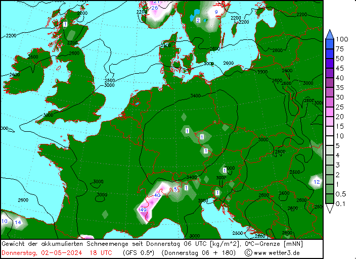
Cooler weather arriving tomorrow, more so in the east which also looks like benefitting from more fresh snowfall.

After that temperatures again pushing up to become very warm before another brief cooler (though not cold) interlude mid month.
|
|
|
|
|
|
|
|
@nozawaonsen, a prolonged period of high pressure is really needed now, and a dump of snow would be most welcome prior to that, and that does seem to be on the cards for a fair % of locations tomorrow night.
But there after would seem we're back to the same volatile weather pattern of the last couple of weeks influenced by small areas of low pressure and associated warm fronts and troughs tracking through.
I'm just back from skiing La Grave and it's the first time we've been able to see the mountains and what's happened in the past week, and it's a very depressing picture driving back and forth with so many faces trashed by huge wet snow slides.

And as you can see these are not limited to S facing slopes!
As one does in LG you do tend to chat to people in the telecabine, especially today as everyone was on a high at the prospect of the conditions (more in a LG thread later), and spoke to a couple of different guides who were trying to do their best for their clients.
One German guide was with a group of Brits and they had bailed out of the Haute Route this week as conditions were so dire, along with another guide who had traveled down from Chamonix too with his group, and they were commenting how next week is not good and with the lack of a freeze / melt there will continue to be these slides.
I hasten to add this is all relevant to off piste.
|
|
|
|
|
|
|
|
|
@Weathercam, that pic looks horribly post-processed??? Sounds like doing my debut tour a few weeks back with freezing overnight was a good plan then!!
|
|
|
|
|
|
You'll get to see more forums and be part of the best ski club on the net.
You'll get to see more forums and be part of the best ski club on the net.
|
| kitenski wrote: |
| @Weathercam, that pic looks horribly post-processed??? |
Guilty as charged - but wanted to hightlight the slide as the colours in the slide were quite stunning with the sun on it.
Snow amounts again have been reduced on various models as we get within the 24hrs of the forecast and not as cold as forecasts were predicting five days ago 
Only good news is that there is now a fair amount of sunshine and I'll gladly take that over what we've endured the past week or so.
|
|
|
|
|
|
|
|
It's been a horrible day here. Cold and foggy earlier. Now cold, foggy and snowing. I am not begrudging cleaning the apartment.
Yesterday I enjoyed a walk up above Beaufort but today really is the pits.
|
|
|
|
|
|
snowHeads are a friendly bunch.
snowHeads are a friendly bunch.
|
As expected snowfall has been focussed in the eastern Alps.
SLF
"Observed weather on Friday,
Skies were heavily overcast, accompanied by some precipitation. The snowfall level in northern regions was at approximately 1000 m, in the furthermost southern regions at 2000 m.
Fresh snow
Above approximately 1600 m in northern regions, and above 2400 m in southern regions, the following amounts of fresh fallen snow were registered:
- from the western part of Ticino over Vals and the Surselva into the southern parts of the Glarner Alps and St. Gallen Alps: 20 to 40 cm;
- Gotthard region, remaining parts of northern and central Grisons, remaining parts of the eastern sector of the northern flank of the Alps: 10 to 20 cm;
- in other regions of Switzerland, less than 10 cm;
- in western regions it remained predominantly dry.
Temperature
At midday at 2000 m, between -4 °C in northern regions and +2 °C in southern regions.
Wind
Winds were blowing at light to moderate strength, from northeasterly directions in the lower strata on the northern flank of the Alps, from southerly directions above those altitudes and in the remaining regions of
Switzerland.
Weather forecast through Saturday, 9.4.2016
Skies will be heavily overcast for the most part, accompanied by only very short bright intervals during the afternoon in particular. In the Valais and in Ticino, more extended sunny spells are anticipated. During the night, precipitation is expected over widespread areas which will come to an end in the early morning hours, including in the central and eastern sectors of the northern flank of the Alps. The snowfall level in northern regions will be at approximately 1200 m, in southern regions at approximately 1700 m.
Fresh snow
By Saturday evening above 1500 m in northern regions, and above 2000 m in southern regions, the following amounts of fresh fallen snow are anticipated:
- northern flank of the Alps west of the Reuss, Valais, western part of Ticino: 10 to 20 cm;
- remaining regions of Switzerland: less than 10 cm.
Temperature
At midday at 2000 m, -5 °C in northern regions and +1 °C in southern regions."
LWD Tirol
"Snow Layering
Last night snowfall set in widespread in Tirol, the snowfall level gradually dropping to 1200-1000m. In the southern and northern Stubai Alps, Tux and Zillertal Alps and along the East Tirolean Tauern Ridge there was as much as 20 cm of fresh fallen snow registered, even more from place to place. In the remaining regions of North Tirol, there was 5-10 cm of new fallen snow. Winds were southerly, blowing at moderate strength, amidst brisk gusts, which led to new, small-sized snowdrift accumulations forming. Beware: inside the showers are patches of graupel, which tend to form perfectly smooth surfaces for avalanches to release on. Fresh fallen and freshly drifted snow now blanket a thoroughly wet snowpack up to 2400 m on shady slopes, up to 3000m on sunny slopes.
Alpine Weather Forecast (ZAMG-Weather Service Innsbruck)
Weather: a low is moving from southern Italy towards Hungary, pushing moist, cool air masses into Tirol. On Sunday, a high will gain the upper hand. At the beginning of next week, some mild, foehn-induced conditions will take over. Mountain weather today: poor visibility, intermittent snowfall, becoming heavier as the day unfolds. By tomorrow, 5-15 cm of fresh fallen snow is expected, most of which will be between Zillertal Alps, Dolomites and East Tirol. Temperatures have dropped: at 2000m, between -4 degrees in the Northern Alps and +1 degree between Ortler and Carnic Alps; at 3000m, -5 degrees. Generally light SW winds, soon shifting to NE."
|
|
|
|
|
|
And love to help out and answer questions and of course, read each other's snow reports.
And love to help out and answer questions and of course, read each other's snow reports.
|
Snowing almost "heavy" here now - going to be interesting to see how this pans out.
You can see it on the cam - though no doubt as soon as I post this it will ease back.
You out skiing tomorrow then Nozza ?
|
|
|
|
|
|
|
|
|
Snowing heavily in Champoluc too.
|
|
|
|
|
|
You know it makes sense.
|
Mmmmm Friday and Saturday though FL's circa 2500............
Last Friday and Saturday here we never saw the predicted cold snap, but there was around 5cm of fresh but disappeared very quickly.
Last few days we've seen freeze / melt with some good spring skiing conditions and then in the afternoons temps nigh on 18 degrees enough to tempt the lizards out !!

|
|
|
|
|
|
Otherwise you'll just go on seeing the one name:
Otherwise you'll just go on seeing the one name:
|
|
Snowing down to 1500 here in Hintertux this morning.
|
|
|
|
|
|
Poster: A snowHead
|
|
|
|
Obviously A snowHead isn't a real person
Obviously A snowHead isn't a real person
|
|
And I recall reports of some stupidly warm (above freezing) temperature at the North Pole in mid winter.
|
|
|
|
|
|
Well, the person's real but it's just a made up name, see?
Well, the person's real but it's just a made up name, see?
|
Whitegold, i think you and The Independent have got this all wrong.
I remember seeing a documentary about this not so long ago, and the clear impression was that in this scenario the glaciers would get a lot bigger.
|
|
|
|
|
|
You need to Login to know who's really who.
You need to Login to know who's really who.
|
| Quote: |
in this scenario the glaciers would get a lot bigge
|
that would be wonderful, but so far, so shrinky..... I skied in Tignes some years ago with an Evo2 Instructor who had been in the town 20 years. It was quite an eye opener when he pointed out where the glacier had been during his first year.
|
|
|
|
|
|
Anyway, snowHeads is much more fun if you do.
Anyway, snowHeads is much more fun if you do.
|
|
|
|
You'll need to Register first of course.
You'll need to Register first of course.
|
|
@bruisedskier, that's scary stuff!
|
|
|
|
|
|
|
|
|
|
|
|
|
|
|
|
You'll get to see more forums and be part of the best ski club on the net.
You'll get to see more forums and be part of the best ski club on the net.
|
|
|
|
|
|

is that "inane", in the sense that it is inane to imply that a period of ideal skiing (in a less than stellar season) gives the lie to the evidence of global warming?
|
|
|
|
|
|
|
|


